Home
All maps
History maps
Popular maps
Regional maps of Russia and countries of the former Soviet Union:
M
oscow
S
aint Petersburg
A
bakan
Anadyr
Arkhangelsk
Astrakhan
B
arnaul
Belgorod
Birobidzhan
Blagoveshchensk
Bryansk
C
heboksary
Chelyabinsk
Chita
E
lista
G
orno-Altaysk
I
rkutsk
Ivanovo
Izhevsk
K
aliningrad
Kaluga
Kazan
Kemerovo
Khabarovsk
Khanty-Mansiysk
Kirov
Kostroma
Krasnodar
Krasnoyarsk
Kurgan
Kursk
Kyzyl
L
ipetsk
M
agadan
Maykop
Murmansk
N
aryan-Mar
Nizhny Novgorod
Novosibirsk
O
msk
Orenburg
Oryol
P
enza
Perm
Petropavlovsk-Kamchatsky
Petrozavodsk
Pskov
R
ostov-on-Don
Ryazan
S
alekhard
Samara
Saransk
Saratov
Sevastopol
Simferopol
Smolensk
Stavropol
Syktyvkar
T
ambov
Tomsk
Tula
Tver
Tyumen
U
lan-Ude
Ufa
Ulyanovsk
V
eliky Novgorod
Vladimir
Vladivostok
Volgograd
Vologda
Voronezh
Y
akutsk
Yaroslavl
Yekaterinburg
Yoshkar-Ola
Yuzhno-Sakhalinsk
•
Belarus
Kazakhstan
Ukraine
Other countries
SORT BY:
New Arrivals
Oldest to Newest
Newest to Oldest
Most Popular
MAP TYPE:
All
City plans
Detailed
Overview
Thematic
History
Popular
Online historical maps of Kursk region
Map fragment
Map name
Year
Region
-
Map type
Preview
4600 x 3400 Views per day:
8
Accuracy:
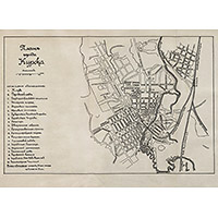
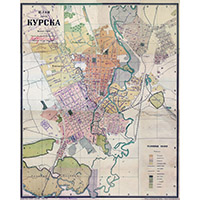
Kursk city plan 1905
1905
Kursk - city plan
43400 x 39600 Views per day:
30
Accuracy:
Satellite map of Kursk 1984
1984
Kursk - city plan
2000 x 1400 Views per day:
8
Accuracy:
Map of Kursk region. Great Soviet Encyclopedia.
1972
Kursk region - overview map
7800 x 5200 Views per day:
40
Accuracy:
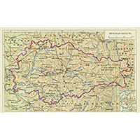
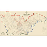
Map of Kursk region districts
1991
Kursk region - detailed map
8000 x 8200 Views per day:
20
Accuracy:
Map of Kursk region 1943
1943
Kursk region - detailed map
17600 x 17600 Views per day:
20
Accuracy:
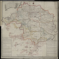
Geometric map of the Kursk governorship of the end of the 18th century
1785
Kursk region - detailed map
8800 x 8800 Views per day:
20
Accuracy:
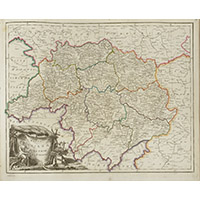
Map of Kursk and part of the Sloboda provinces, 1797
1797
Kursk region - detailed map
4200 x 3400 Views per day:
20
Accuracy:
Schematic map of the CChO 1928
1928
Voronezh region - overview map
2200 x 2600 Views per day:
10
Accuracy:
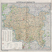
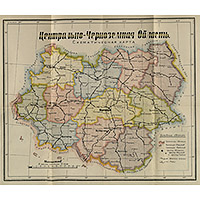
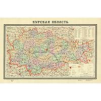
Administrative divisions map of Kursk region 1935
1935
Kursk region - overview map
8800 x 7200 Views per day:
10
Accuracy:
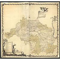
Kursk province from the Wilbrecht atlas, 1800
1800
Kursk region - detailed map
8200 x 5400 Views per day:
7
Accuracy:
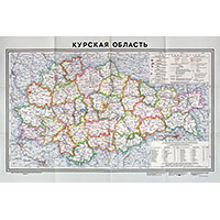
Administrative map of the Kursk region, 1957
1957
Kursk region - overview map
6000 x 7400 Views per day:
4
Accuracy:
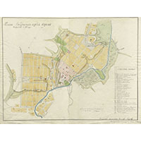
Plan of the city of Kursk 1935
1935
Kursk - city plan
7800 x 8400 Views per day:
10
Accuracy:
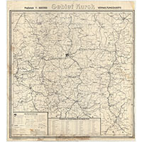
German map of the Kursk region, 1940
1940
Kursk region - overview map
6400 x 6000 Views per day:
3
Accuracy:
Plan of the provincial city of Kursk 1836
1836
Kursk - city plan
18800 x 17800 Views per day:
2
Accuracy:
Map of the Putivl district of the Kursk province, 1910
1910
Detailed map
NEXT
1
2
3
4
5
>>>