Home
All maps
History maps
Popular maps
Regional maps of Russia and countries of the former Soviet Union:
M
oscow
S
aint Petersburg
A
bakan
Anadyr
Arkhangelsk
Astrakhan
B
arnaul
Belgorod
Birobidzhan
Blagoveshchensk
Bryansk
C
heboksary
Chelyabinsk
Chita
E
lista
G
orno-Altaysk
I
rkutsk
Ivanovo
Izhevsk
K
aliningrad
Kaluga
Kazan
Kemerovo
Khabarovsk
Khanty-Mansiysk
Kirov
Kostroma
Krasnodar
Krasnoyarsk
Kurgan
Kursk
Kyzyl
L
ipetsk
M
agadan
Maykop
Murmansk
N
aryan-Mar
Nizhny Novgorod
Novosibirsk
O
msk
Orenburg
Oryol
P
enza
Perm
Petropavlovsk-Kamchatsky
Petrozavodsk
Pskov
R
ostov-on-Don
Ryazan
S
alekhard
Samara
Saransk
Saratov
Sevastopol
Simferopol
Smolensk
Stavropol
Syktyvkar
T
ambov
Tomsk
Tula
Tver
Tyumen
U
lan-Ude
Ufa
Ulyanovsk
V
eliky Novgorod
Vladimir
Vladivostok
Volgograd
Vologda
Voronezh
Y
akutsk
Yaroslavl
Yekaterinburg
Yoshkar-Ola
Yuzhno-Sakhalinsk
•
Belarus
Kazakhstan
Ukraine
Other countries
SORT BY:
New Arrivals
Oldest to Newest
Newest to Oldest
Most Popular
MAP TYPE:
All
City plans
Detailed
Overview
Thematic
History
Popular
Historical maps of Russia and the USSR
Map fragment
Map name
Year
Region
-
Map type
Preview
10000 x 7200 Views per day:
10
Accuracy:
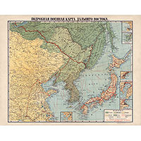
Military map of the Far East, 1904
1904
History map
7600 x 4800 Views per day:
10
Accuracy:
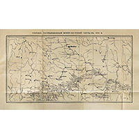
Map of villages near the Zasechnaya Cherta in the 17th century
1650
History map
7600 x 4800 Views per day:
10
Accuracy:
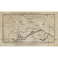
Map of the Zasechnaya Cherta of the Muscovite State in the 17th century
1650
History map
15400 x 6200 Views per day:
7
Accuracy:
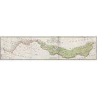
Map of the border between Russia and China at the end of the 18th century
1790
History map
7400 x 5800 Views per day:
10
Accuracy:
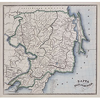
Map of Manchuria in the first half of the 19th century
1850
History map
1800 x 2200 Views per day:
1
Accuracy:
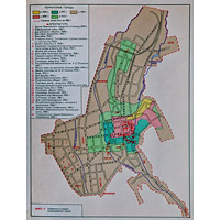
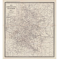
Scheme of Almaty territory growth by years up to 1983
1983
History map
3800 x 7200 Views per day:
20
Accuracy:
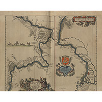
Volga map of 1663 by Adamo Oleario
1663
History map
11800 x 7800 Views per day:
50
Accuracy:
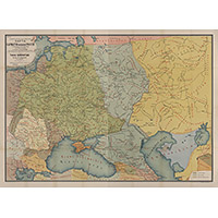
Map of Sarmatia in the 2nd century according to Ptolemy
150
History map
16200 x 10000 Views per day:
140
Accuracy:
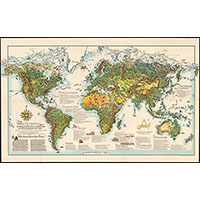
Illustrated Map of the Post-War World 1947
1947
History map
5800 x 5800 Views per day:
10
Accuracy:
Map of the Great Russian center after unification in the 16th century
1540
History map
11400 x 7400 Views per day:
30
Accuracy:
Map of the borders of European states in 1444 by reddit/ratkatavobratka
1444
History map
3600 x 3400 Views per day:
20
Accuracy:
Map of the Grand Duchy of Lithuania in the 14th - 15th centuries
1263
-
1465
History map
5000 x 4000 Views per day:
10
Accuracy:
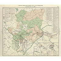
Map of the struggle of North-Eastern Russia with the Tatar yoke
1357
-
1462
History map
5000 x 3400 Views per day:
50
Accuracy:
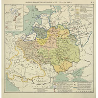
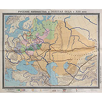
Map of the Golden Horde and Russian principalities in the 13th century
1242
History map
12000 x 8800 Views per day:
50
Accuracy:
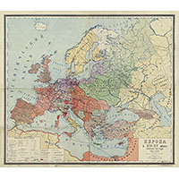
Map of Europe with borders in 1400
1400
History map
NEXT
1
2
3
4
5
>>>