Home
All maps
History maps
Popular maps
Regional maps of Russia and countries of the former Soviet Union:
M
oscow
S
aint Petersburg
A
bakan
Anadyr
Arkhangelsk
Astrakhan
B
arnaul
Belgorod
Birobidzhan
Blagoveshchensk
Bryansk
C
heboksary
Chelyabinsk
Chita
E
lista
G
orno-Altaysk
I
rkutsk
Ivanovo
Izhevsk
K
aliningrad
Kaluga
Kazan
Kemerovo
Khabarovsk
Khanty-Mansiysk
Kirov
Kostroma
Krasnodar
Krasnoyarsk
Kurgan
Kursk
Kyzyl
L
ipetsk
M
agadan
Maykop
Murmansk
N
aryan-Mar
Nizhny Novgorod
Novosibirsk
O
msk
Orenburg
Oryol
P
enza
Perm
Petropavlovsk-Kamchatsky
Petrozavodsk
Pskov
R
ostov-on-Don
Ryazan
S
alekhard
Samara
Saransk
Saratov
Sevastopol
Simferopol
Smolensk
Stavropol
Syktyvkar
T
ambov
Tomsk
Tula
Tver
Tyumen
U
lan-Ude
Ufa
Ulyanovsk
V
eliky Novgorod
Vladimir
Vladivostok
Volgograd
Vologda
Voronezh
Y
akutsk
Yaroslavl
Yekaterinburg
Yoshkar-Ola
Yuzhno-Sakhalinsk
•
Belarus
Kazakhstan
Ukraine
Other countries
Online historical maps of Russia and the USSR
Map fragment
Map name
Year
Region
-
Map type
Preview
4400 x 3400 Views per day:
10
Accuracy:
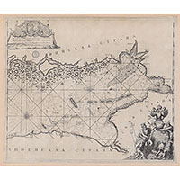
Map of the Gulf of Finland, 1703
1703
World - overview map
7200 x 6000 Views per day:
9
Accuracy:
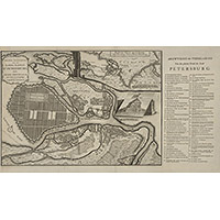
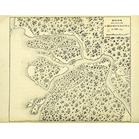
Plan of St. Petersburg 1703 by Broedelet Johannes
1703
Saint Petersburg - city plan
3800 x 3600 Views per day:
1
Accuracy:
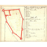
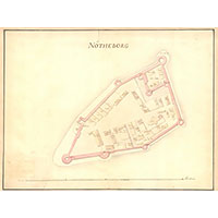
Plan of the siege of the fortress of Noteburg in 1702
1702
Map of Shlisselburg
3200 x 3800 Views per day:
0
Accuracy:
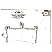
Plan of the Noteburg fortress in 1696
1696
Map of Shlisselburg
4000 x 3000 Views per day:
0
Accuracy:
Plan of Noteburg from 1697 with profiles of the fortress walls
1697
Map of Shlisselburg
4000 x 2600 Views per day:
1
Accuracy:
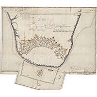
Swedish plan of the Noteburg fortress area from 1699
1699
Map of Shlisselburg
3600 x 2800 Views per day:
0
Accuracy:
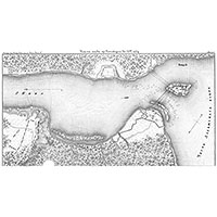
Swedish plan of Nöteborg Fortress, 1697
1697
Map of Shlisselburg
5200 x 4200 Views per day:
20
Accuracy:
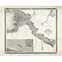
Map of the area one year before the founding of St. Petersburg
1702
Saint Petersburg - city plan
3800 x 2600 Views per day:
2
Accuracy:
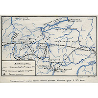
Map of the southern border of Tomsk district in the 17th century
1696
History map
7000 x 7400 Views per day:
1
Accuracy:
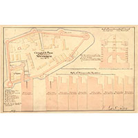
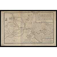
Project for the construction of the Trinity Fortress on Tagan-Rog, 1704
1704
Map of Taganrog
2400 x 2600 Views per day:
1
Accuracy:
Plan of the Taganrog harbor and Fort Turtle
1704
Map of Taganrog
5800 x 4600 Views per day:
20
Accuracy:
Map of the area of the future location of St. Petersburg in 1698
1698
Saint Petersburg - city plan
9000 x 7400 Views per day:
10
Accuracy:
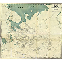
Map of the Pomorie region in the 17th century
1650
-
1700
History map
3800 x 3000 Views per day:
2
Accuracy:
Зlan of St. Petersburg in 1700
1700
History map
6400 x 7000 Views per day:
4
Accuracy:
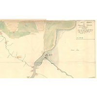
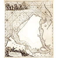
Map of the Dvina estuary 1701
1701
Arkhangelsk region - detailed map
NEXT