Home
All maps
History maps
Popular maps
Regional maps of Russia and countries of the former Soviet Union:
M
oscow
S
aint Petersburg
A
bakan
Anadyr
Arkhangelsk
Astrakhan
B
arnaul
Belgorod
Birobidzhan
Blagoveshchensk
Bryansk
C
heboksary
Chelyabinsk
Chita
E
lista
G
orno-Altaysk
I
rkutsk
Ivanovo
Izhevsk
K
aliningrad
Kaluga
Kazan
Kemerovo
Khabarovsk
Khanty-Mansiysk
Kirov
Kostroma
Krasnodar
Krasnoyarsk
Kurgan
Kursk
Kyzyl
L
ipetsk
M
agadan
Maykop
Murmansk
N
aryan-Mar
Nizhny Novgorod
Novosibirsk
O
msk
Orenburg
Oryol
P
enza
Perm
Petropavlovsk-Kamchatsky
Petrozavodsk
Pskov
R
ostov-on-Don
Ryazan
S
alekhard
Samara
Saransk
Saratov
Sevastopol
Simferopol
Smolensk
Stavropol
Syktyvkar
T
ambov
Tomsk
Tula
Tver
Tyumen
U
lan-Ude
Ufa
Ulyanovsk
V
eliky Novgorod
Vladimir
Vladivostok
Volgograd
Vologda
Voronezh
Y
akutsk
Yaroslavl
Yekaterinburg
Yoshkar-Ola
Yuzhno-Sakhalinsk
•
Belarus
Kazakhstan
Ukraine
Other countries
Online historical maps of Russia and the USSR
Map fragment
Map name
Year
Region
-
Map type
Preview
14600 x 10400 Views per day:
4
Accuracy:
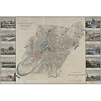
Plan of the capital city of Moscow in 1827 by Savinkov
1827
Moscow - city plan
10800 x 10200 Views per day:
2
Accuracy:
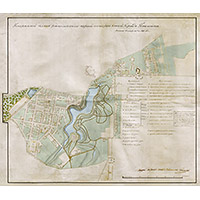
General plan of the 1st and 2nd parts of the city of Pavlovsk in 1829
1829
Map of Pavlovsk
17000 x 15000 Views per day:
20
Accuracy:
General plan of the city of Sevastopol in 1828
1828
Sevastopol - city plan
7600 x 5800 Views per day:
2
Accuracy:
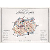
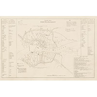
Plan of the provincial town of Orel in 1828
1828
Oryol - city plan
12200 x 18400 Views per day:
10
Accuracy:
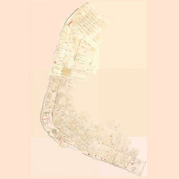
Detailed map of Arkhangelsk in 1828 with houses
1828
Arkhangelsk - city plan
14200 x 12000 Views per day:
0
Accuracy:
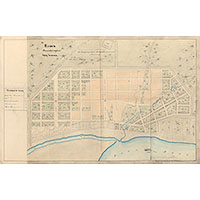
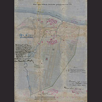
City plan of Chistopol 1829
1829
Map of Chistopol
5000 x 4600 Views per day:
1
Accuracy:
Plan of Kharkov 1827
1827
City plan
1400 x 2000 Views per day:
2
Accuracy:
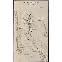
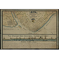
Map of Petropaulski Harbour in 1827
1827
Petropavlovsk-Kamchatsky - city plan
8000 x 5800 Views per day:
0
Accuracy:
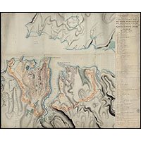
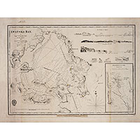
Map of Avacha Bay in 1827
1827
Kamchatka territory - detailed map
5400 x 6400 Views per day:
2
Accuracy:
Plan of the provincial city of Arkhangelsk in 1829
1829
Arkhangelsk - city plan
5200 x 9200 Views per day:
1
Accuracy:
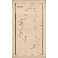
Map of the land of Yamal from the inventory of navigator Ivanov
1827
-
1828
Yamal-Nenets autonomous area - overview map
10600 x 8200 Views per day:
2
Accuracy:
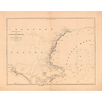
Map of 1828 parts of the Northern Ocean: Barents and Kara Seas
1828
Murmansk region - overview map
4400 x 6000 Views per day:
6
Accuracy:
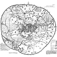
Big plan of ancient Novgorod Velikiy
1828
Veliky Novgorod - city plan
7600 x 10800 Views per day:
2
Accuracy:
Cheboksary city plan approved in 1829
1829
Cheboksary - city plan
4400 x 3800 Views per day:
0
Accuracy:
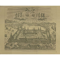
Panorama of the Solovetsky Monastery, 1827
1827
Arkhangelsk region - detailed map
NEXT