Home
All maps
History maps
Popular maps
Regional maps of Russia and countries of the former Soviet Union:
M
oscow
S
aint Petersburg
A
bakan
Anadyr
Arkhangelsk
Astrakhan
B
arnaul
Belgorod
Birobidzhan
Blagoveshchensk
Bryansk
C
heboksary
Chelyabinsk
Chita
E
lista
G
orno-Altaysk
I
rkutsk
Ivanovo
Izhevsk
K
aliningrad
Kaluga
Kazan
Kemerovo
Khabarovsk
Khanty-Mansiysk
Kirov
Kostroma
Krasnodar
Krasnoyarsk
Kurgan
Kursk
Kyzyl
L
ipetsk
M
agadan
Maykop
Murmansk
N
aryan-Mar
Nizhny Novgorod
Novosibirsk
O
msk
Orenburg
Oryol
P
enza
Perm
Petropavlovsk-Kamchatsky
Petrozavodsk
Pskov
R
ostov-on-Don
Ryazan
S
alekhard
Samara
Saransk
Saratov
Sevastopol
Simferopol
Smolensk
Stavropol
Syktyvkar
T
ambov
Tomsk
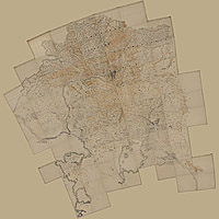
Tula
Tver
Tyumen
U
lan-Ude
Ufa
Ulyanovsk
V
eliky Novgorod
Vladimir
Vladivostok
Volgograd
Vologda
Voronezh
Y
akutsk
Yaroslavl
Yekaterinburg
Yoshkar-Ola
Yuzhno-Sakhalinsk
•
Belarus
Kazakhstan
Ukraine
Other countries
Online historical maps of Russia and the USSR
Map fragment
Map name
Year
Region
-
Map type
Preview
10600 x 16000 Views per day:
4
Accuracy:
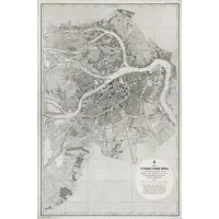
Map of the mouths of the Neva River, 1867
1867
Saint Petersburg - city plan
6800 x 7000 Views per day:
2
Accuracy:
Map of the environs of Verny (Almaty) 1868
1868
Kazakhstan - detailed map
12400 x 11400 Views per day:
3
Accuracy:
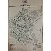
Plan of the city of Venev, Tula province, 1868
1868
Map of Venyov
11600 x 6600 Views per day:
10
Accuracy:
Map of the western outskirts of Smolensk, 1868
1868
Smolensk region - detailed map
5800 x 6200 Views per day:
3
Accuracy:
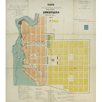
Old map of Borisoglebsk, 1867
1867
Map of Borisoglebsk
4600 x 6200 Views per day:
0
Accuracy:
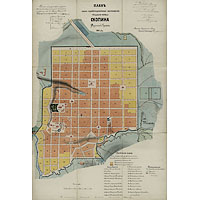
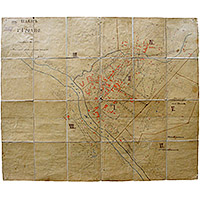
Plan of the district town of Skopin in 1867
1867
Map of Skopin
24000 x 33200 Views per day:
30
Accuracy:
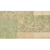
Military topographic three-verst map of the Moldova
1865
-
1893
World - detailed map
36800 x 25000 Views per day:
5
Accuracy:
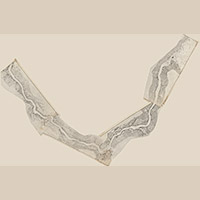
Map of the Neva River with depths in 1869 by Captain Polikarpov
1862
-
1899
Leningrad region - detailed map
39600 x 40800 Views per day:
80
Accuracy:
Atlas of the Orenburg Territory, 1869
1869
Russia and USSR - detailed map
2400 x 2800 Views per day:
1
Accuracy:
Plan of Grodno in 1868
1868
Map of Grodno
3200 x 2800 Views per day:
1
Accuracy:
Plan of the city of Grodno in 1867
1867
Map of Grodno
4400 x 6200 Views per day:
2
Accuracy:
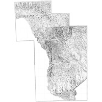
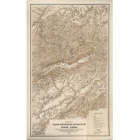
Map of a part of the Olekminsk-Vitim mountainous country
1867
-
1882
Republic of Sakha (Yakutia) - detailed map
7600 x 6400 Views per day:
5
Accuracy:
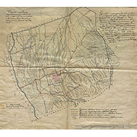
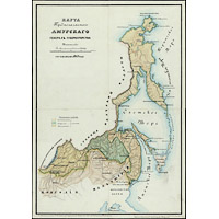
Map of the Proposed Area for the Amur Governor-Generalship 1869
1869
Amur region - overview map
17400 x 12600 Views per day:
7
Accuracy:
Plan of the capital city of Moscow and its environs 1868
1868
Moscow - city plan
5800 x 4400 Views per day:
0
Accuracy:
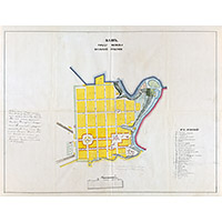
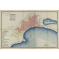
Project plan for the settlement of Evpatoria in 1867
1867
Map of Evpatoria
NEXT