Home
All maps
History maps
Popular maps
Regional maps of Russia and countries of the former Soviet Union:
M
oscow
S
aint Petersburg
A
bakan
Anadyr
Arkhangelsk
Astrakhan
B
arnaul
Belgorod
Birobidzhan
Blagoveshchensk
Bryansk
C
heboksary
Chelyabinsk
Chita
E
lista
G
orno-Altaysk
I
rkutsk
Ivanovo
Izhevsk
K
aliningrad
Kaluga
Kazan
Kemerovo
Khabarovsk
Khanty-Mansiysk
Kirov
Kostroma
Krasnodar
Krasnoyarsk
Kurgan
Kursk
Kyzyl
L
ipetsk
M
agadan
Maykop
Murmansk
N
aryan-Mar
Nizhny Novgorod
Novosibirsk
O
msk
Orenburg
Oryol
P
enza
Perm
Petropavlovsk-Kamchatsky
Petrozavodsk
Pskov
R
ostov-on-Don
Ryazan
S
alekhard
Samara
Saransk
Saratov
Sevastopol
Simferopol
Smolensk
Stavropol
Syktyvkar
T
ambov
Tomsk
Tula
Tver
Tyumen
U
lan-Ude
Ufa
Ulyanovsk
V
eliky Novgorod
Vladimir
Vladivostok
Volgograd
Vologda
Voronezh
Y
akutsk
Yaroslavl
Yekaterinburg
Yoshkar-Ola
Yuzhno-Sakhalinsk
•
Belarus
Kazakhstan
Ukraine
Other countries
SORT BY:
New Arrivals
Oldest to Newest
Newest to Oldest
Most Popular
MAP TYPE:
All
City plans
Detailed
Overview
Thematic
History
Popular
Online historical maps of Ukraine
Map fragment
Map name
Year
Region
-
Map type
Preview
2600 x 2000 Views per day:
3
Accuracy:
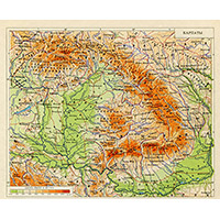
Map of the Carpathians. Great Soviet Encyclopedia.
1972
Overview map
2000 x 1400 Views per day:
2
Accuracy:
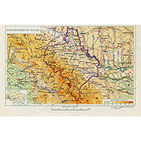
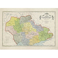
Map of Kirovograd region. Great Soviet Encyclopedia.
1972
Overview map
2000 x 1400 Views per day:
1
Accuracy:
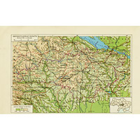
Map of Ivano-Frankivsk region. Great Soviet Encyclopedia.
1971
Overview map
1400 x 1600 Views per day:
1
Accuracy:
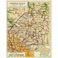
Map of Lviv region. Great Soviet Encyclopedia.
1973
Overview map
24600 x 16400 Views per day:
6
Accuracy:
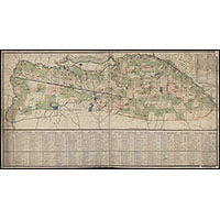
Map of the Elisavetgrad province of the Novorossiysk governorate in 1774
1774
Detailed map
7200 x 4800 Views per day:
20
Accuracy:
Map of the Ukrainian SSR 1921
1921
Overview map
4200 x 6000 Views per day:
1
Accuracy:
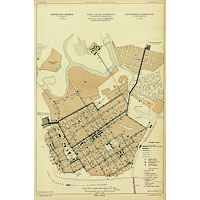
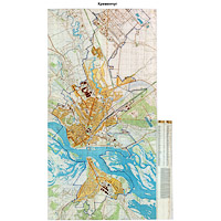
Plan of the city of Kremenchug in 1894
1894
Detailed map
15200 x 10400 Views per day:
40
Accuracy:
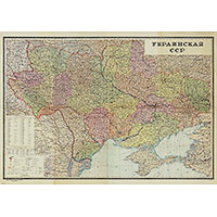
Map of Ukraine 1944
1944
Overview map
11400 x 15000 Views per day:
4
Accuracy:
Topographic map of Nikolaev 1991
1991
City plan
8400 x 13600 Views per day:
2
Accuracy:
Topographic map of Kremenchug 1979
1979
Detailed map
15800 x 10800 Views per day:
30
Accuracy:
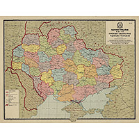
Administrative map of the Ukrainian SSR 1958
1958
Overview map
14000 x 10400 Views per day:
20
Accuracy:
Administrative map of the Ukrainian SRR 1925
1925
Overview map
19000 x 21400 Views per day:
20
Accuracy:
Military topographic three-verst map of the Chernigov region
1866
-
1919
Detailed map
8600 x 6800 Views per day:
4
Accuracy:
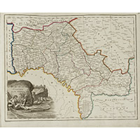
Podolsk province from the Wilbrecht atlas, 1800
1800
Detailed map
9000 x 6600 Views per day:
20
Accuracy:
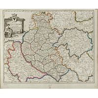
Little Russia province from the Wilbrecht atlas, 1800
1800
Detailed map
NEXT
1
2
3
4
5
>>>